Template is a set of actions to be applied to get a heightmap. Template can be pretty prescriptive and provide similar-looking heightmaps on each execution, but there is always a significant level of randomness that allow templates to produce different maps of the same type.
The Template Editor is opened from the Tools tab → Heightmap → Erase mode → Template editor.
Possible actions (buttons in the toolbar) are:
| Button | Action | Parameters |
|---|---|---|
| H | Hill — a small blob that raises the surrounding land | y, x, h, n |
| P | Pit — a round depression | y, x, h, n |
| R | Range — an elongated elevation | y, x, h, n |
| T | Trough — an elongated depression | y, x, h, n |
| S | Strait — a vertical or horizontal depression across the map | d, w |
| M | Mask — lower cells near the edges or in the map center | f |
| I | Invert — mirror the heightmap along an axis | by, n |
| + | Add — add or subtract a value from heights in the selected range | to, v |
| * | Multiply — multiply heights in the selected range by a factor | to, v |
| ~ | Smooth — replace cell heights with the average of their neighbors | f |
Parameter meanings:
n— how many blobs to add. Use a hyphen to get a random number in a range, e.g.2-5. For Invert it is instead the probability of inversion, in the0-1rangeh— the target height, from0(deep ocean) to100(maximum height);20is land at sea level. Use a hyphen for a random value in a rangexandy— placement range as percentages of the map.xruns from 0 at the left to 100 at the right,yfrom 0 at the top to 100 at the bottom. Use a hyphen for a range, e.g.65-75w— strait width, capped at a third of the map width. Values below 1 act as the probability that the strait is created at alld— strait direction: vertical or horizontalby— the axis to mirror along:x,yor bothf— fraction:1is the full effect,2blends the result half-way with the original, and so on. For Mask a negative value inverts the effectv— the value to add (may be negative) or to multiply byto— which cells the change applies to: all cells, land only (height 20 and above, and never pushed below 20), or interval, which prompts for a custom height range like17-20
A step can be skipped by clicking the check icon on its left, removed with the trash icon, and reordered by dragging the double-arrow handle.
To run the template click ▶ or press Enter. The heightmap is reset to zero before the run, so the template always starts from a blank map. The undo / redo buttons step through the result of each action. If you enter a Seed, the template produces the same heightmap on every execution; leave it empty for a new random seed each run.
The remaining buttons let you download the template as a text file, upload a previously saved one, and open the Cartography Assets portal to find or share templates.
The Select template dropdown loads one of the built-in templates as a starting point: Volcano, High Island, Low Island, Continents, Archipelago, Atoll, Mediterranean, Peninsula, Pangea, Isthmus, Shattered, Taklamakan, Old World and Fractious. Selecting a template discards the current steps.
Hill
When you open the Template Editor, the instruction is like this:
Hill n:1 h:90-100 x:65-75 y:47-53
This says to add 1 hill, of a random height between 90-100, somewhere in the center-right of the map.
To test it, change the Hill entry to:
Hill n:1 h:20 x:50-50 y:50-50
If you click Execute template, it will show a map with just a few land cells right in the map center.
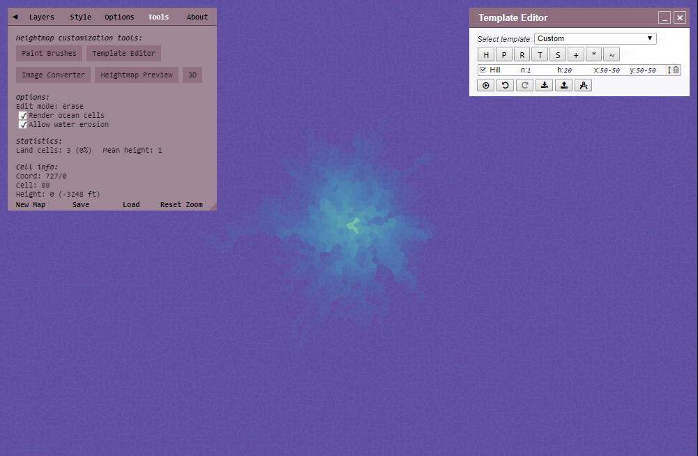
I suggest you enable "Render ocean cells" option to see the effect it has on the ocean depths.
Now change n:1 to n:2
You will see massive change — this is because the land has been raised by 40 height in total.
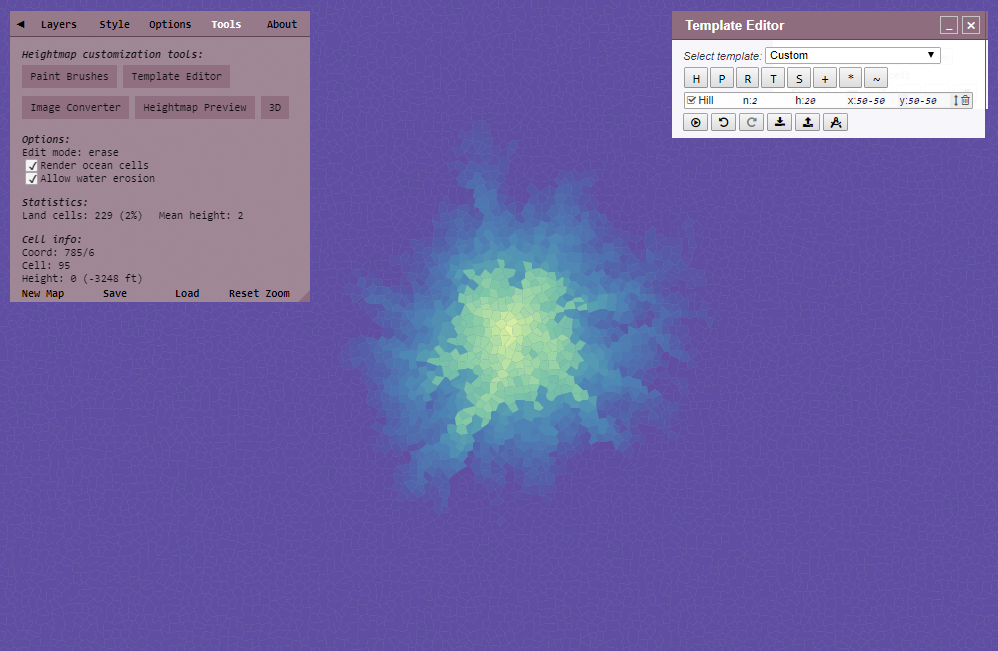
Hills are main 'bricks' that construct a heightmap.
Pit
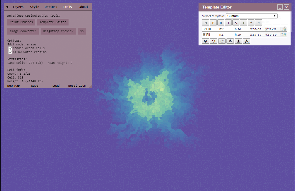
Pit is the opposite of Hill, it creates a "hole".
To test it, add a Pit so your instructions look like this:
Hill n:2 h:20 x:50-50 y:50-50Pit n:1 h:20 x:50-50 y:50-50
Run it and you will see a hole — the exact look will vary a bit.
Range
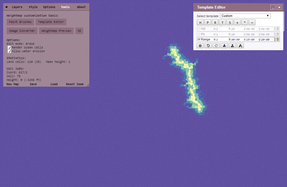
Add a range and disable the Hill and Pit entries.
You will see it makes an elongated raised area.
Range n:1 h:40-50 x:15-85 y:20-80
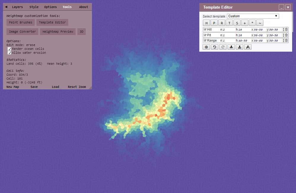
If you change the Range and enable the Hill and Pit, you will see that it combines:
Hill n:2 h:20 x:50-50 y:50-50Pit n:1 h:20 x:50-50 y:50-50Range n:1 h:40-50 x:50-60 y:50-50
Trough
Trough works exactly like Range, except that it lowers height.
Add and Strait
Delete all the instructions and click the + button to get the Add instruction. Add changes height by a fixed value — a negative value lowers it.
Change v to 20 so the line looks like this:
Add to:all cells v:20
Run it and the whole map becomes land at sea level — remember that 20 is the minimum land height.
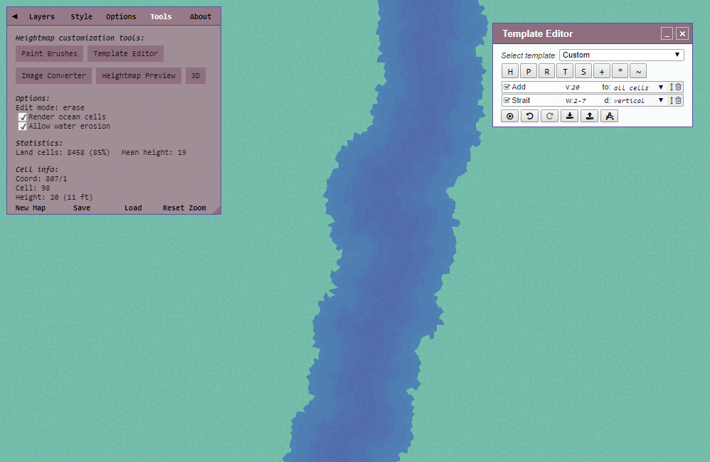
Now add a Strait. It has only two values, direction d (vertical or horizontal) and width w.
Run it and you will see the land divided by a channel somewhere — note that you cannot control the exact location, only the direction.
Multiply
Multiply works like Add, except it scales the existing height, which gives finer control: multiplying by 1.1 raises land slightly, with smaller changes to low values and larger changes to high ones. Values below 1 lower the heights, so multiplying by 0.8 flattens everything a bit. With to:land only the scaling is applied relative to the sea level of 20, so land never drops below the coastline.
Smooth
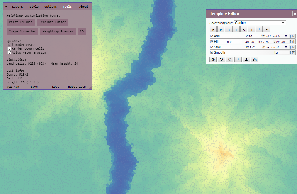
Smooth averages cell heights with their neighbors' heights. The fraction f controls the strength: 1 replaces the height with the plain average, 2 blends it half-way, and so on. This means land next to a pit will lower, and land next to a hill will rise. Smooth removes any spiky bits near land and makes FMG performance better.
Mask
To see what Mask does, assign maximum height (100) to all cells and then add a Mask with the default fraction f:1. It gradually masks the height of the cells along the map edge down to 0.

Fraction 2 blends the masked values with the original ones, so map edges keep a height of 50.

A negative fraction inverts the mask, so cells in the map center are lowered instead.

The fraction can also be a decimal value.

Invert
Invert mirrors the heightmap along the X, Y or both axes. It is useful for maps that lean towards one side. Set n to the probability of the mirroring happening, in the 0-1 range, so that only some of the generated maps get flipped.
